01
Tawas Point Lighthouse Trail
A flat sand-spit loop from the parking lot out to the lighthouse and back along the beach. Sunrise here is unbeatable.
11 state parks. Negwegon for solitude, Rockport for sinkholes and fossils, the Highbanks for the AuSable canyon view. 80 miles of marked trail in total.
Negwegon · early autumn
Curated by Sunrise Coast Council editors. Routes, sites, and pull-offs from south to north along US-23.
A flat sand-spit loop from the parking lot out to the lighthouse and back along the beach. Sunrise here is unbeatable.
Along the AuSable canyon from Lumberman's Monument north. Five overlooks with benches. The Iargo Springs spur drops 300 steps.
No paved roads, no power, no cell. Three loops through pine forest to seven miles of empty beach. The road in is loose sand.
A quiet loop through old-growth white pine to the lighthouse and museum. Good for kids.
A 4,000-acre park on a former quarry. The cliffs have visible Devonian fossils; the inland sinkhole pond is 70 ft deep.
Loops through 600 acres of dark sky preserve to a beach on the Straits. Walk it at dusk and stay for the stars.
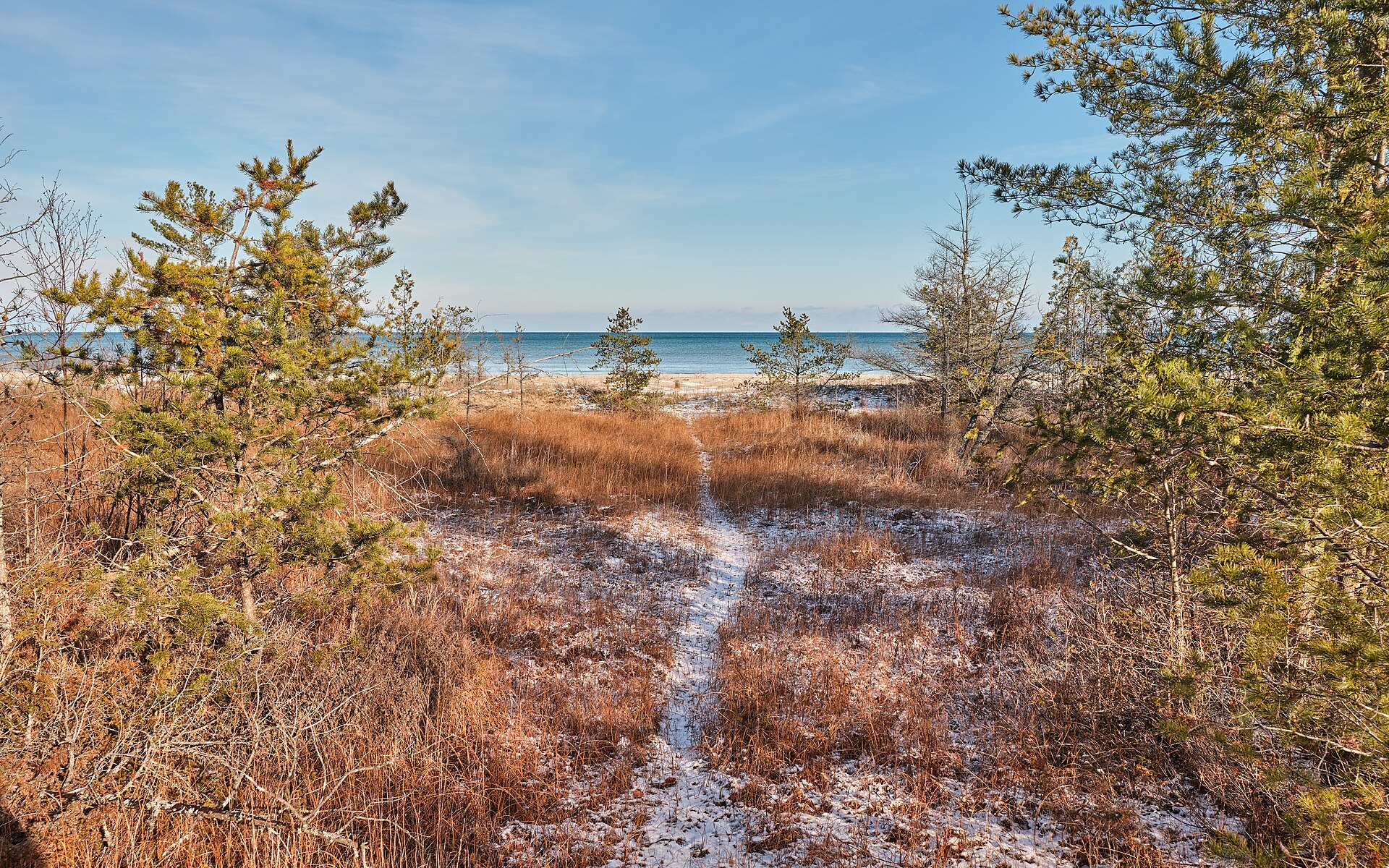
Negwegon is a 4,000-acre state park between Harrisville and Alpena with no electricity, no running water, no cell service, and no marked road in. The DNR keeps the access road deliberately unimproved — loose sand for the last mile and a half — to discourage casual visitors.
What you get for it is seven miles of empty Lake Huron coast, three short trail loops through old-growth white pine, and a kind of quiet you rarely find in lower Michigan. Sandhill cranes stage here in September by the hundreds. Bring water. Bring a map. Tell someone where you're going.
Hiking · negwegon state park
"The trail to Negwegon is unmarked on purpose."— Negwegon SP trail guide, MI DNR
Quick answers to what travelers ask most.
11 state parks. Negwegon for solitude, Rockport for sinkholes and fossils, the Highbanks for the AuSable canyon view. 80 miles of marked trail in total.
The recommended season for hiking on Michigan's Sunrise Coast is April – October. State parks: 11 — On or near the coast.
6 trails along the 200-mile coast. A standout option: Tawas Point Lighthouse Trail — 1.5 mi · Easy · Sand. A flat sand-spit loop from the parking lot out to the lighthouse and back along the beach. Sunrise here is unbeatable.
Bring with you: Water — no fountains in remote parks; Bug spray (May–Aug); Paper map for Negwegon; Bear spray (rare but possible).